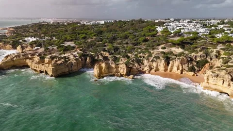
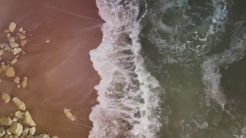
I went to the southern coast of Portugal to logically audit the limestone reality behind the mass-tourism brochures, returning with an archive that strips away the noise. This collection heavily maps the jagged sea caves of the Algarve, while bizarrely but practically incorporating a deep aerial study of Funchal out in the Atlantic.
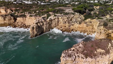
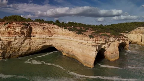
Locations featured in Algarve
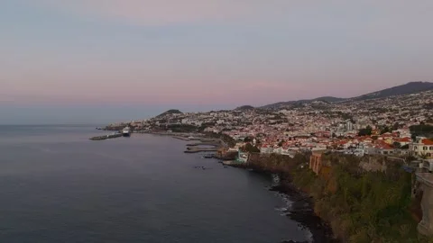
Funchal
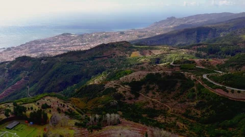
The steep, densely populated coastal capital of Madeira, characterized by white houses with red roofs terraced into lush hillsides.
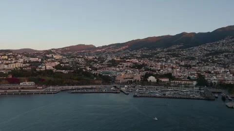
Funchal Marina
A protected harbor filled with moored sailboats, jutting out into the deep waters of the Atlantic.
Sé Cathedral
A historic, late-Gothic architectural landmark standing out within the dense urban center of Funchal.
Convent of Santa Clara
A prominent, historical religious complex surrounded by the sprawling residential layers of the island capital.
Palácio de São Lourenço
A fortified historic palace that serves as a massive architectural anchor on the Funchal waterfront.
Praça do Município
A striking civic square in Funchal, paved with high-contrast, traditional black and white Portuguese mosaic stones.
Paços do Concelho
The commanding historic city hall building facing the mosaic courtyard of Funchal's main municipal square.
St. Peter's Church
A classic religious structure with a distinct tower, integrated tightly into the hilly urban fabric of Madeira.
Jardim Municipal
A dense patch of structured greenery sitting squarely in the middle of Funchal's paved commercial center.
Parque de Santa Catarina
A sloped public park offering a sharp contrast of green grass against the busy maritime infrastructure of the harbor.
Forte de São Tiago
A starkly painted yellow coastal fortress built out of sheer spite to defend the waterfront of Funchal.
Benagil Sea Cave
A massive natural erosion cavity with a collapsed roof skylight, heavily trafficked by coastal boat tours.
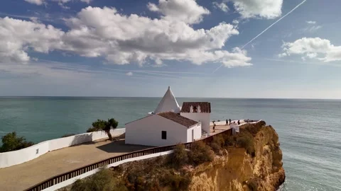
Chapel Nossa Senhora da Rocha
A stark white historical church isolated on a narrow, fortified peninsula jutting straight into the Atlantic.
Ponta da Piedade
A highly fractured limestone headland south of Lagos, defined by towering sea stacks and complex archways.
Farol de Alfanzina
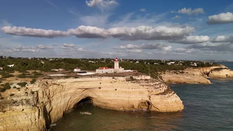
A prominent coastal lighthouse sitting dangerously close to the crumbling edge of a dramatic limestone drop-off.
Sesmarias
A rugged stretch of mainland coast where flat terrain abruptly terminates in deeply eroded, aggressive cliff faces.
Praia da Coelha
A small, sheltered sandy cove locked between towering rock walls along the aggressive Sesmarias coastline.
Praia do Castelo
A deeply recessed beach bordered by highly weathered, castle-like limestone formations that block out the horizon.
Praia dos Arrifes
A chaotic shoreline dominated by massive, jagged rock formations that sit directly in the surf zone.
Praia dos Paradinha
A secluded stretch of sand backed by sheer cliffs, catching incredible directional light during the golden hour.
Evaristo
A rocky section of the Albufeira coast characterized by low-lying limestone shelves and isolated sea stacks.
Albufeira
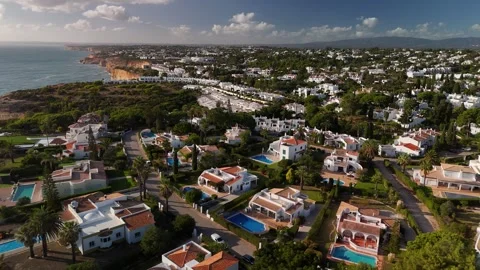
A dense coastal city where historical white architecture violently intersects with modern beachfront development.
Lagos
A working maritime city built at the mouth of a river, mixing deep historical roots with functional modern ports.
Portimão
A major riverfront hub defined by its massive commercial marina and dense, layered urban architecture.
Arade River
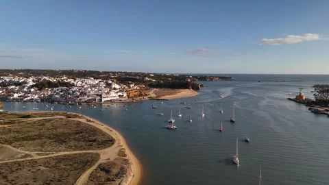
A wide, working waterway that acts as the primary dividing line between Portimão and Ferragudo.
Ferragudo
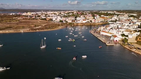
A traditional, tightly packed fishing village situated on the eastern bank of the Arade River.
Alvor
A low-lying coastal town known for its vast wooden boardwalks that bridge the gap between land and ocean.
Bensafrim River
The central waterway cutting directly through the historic center of Lagos out toward the open sea.
Church of Saint Anthony
A prominent religious structure in Lagos, sitting shoulder-to-shoulder with modern street art.
Church of Santana
A classic whitewashed church standing as an architectural anchor within the density of Albufeira.
Ponta da Baleeira
A protruding headland near Albufeira that serves as a logical vantage point for coastal sunrises.
Carvoeiro
A town violently wedged into a steep limestone valley, leading directly down to a tiny, enclosed beach.
Praia da Nova
A long strip of bright sand sitting directly at the base of the towering cliffs near Nossa Senhora da Rocha.
Praia da Corredoura
A narrow, cliff-backed beach accessible via high coastal footpaths near the famous sea caves.
Praia de Alvor
An expansive, flat stretch of sand offering a stark contrast to the vertical drops of the central Algarve.
Porta de São Gonçalo
A rugged, historic stone archway marking the boundary of the old working city in Lagos.
Place Jolie
A heavily paved, active pedestrian square in the center of Lagos surrounded by traditional facades.
Jardim Público de Albufeira
A structured public garden offering a pocket of green space just off the dense commercial avenues.
Avenida da Liberdade
A tree-lined pedestrian artery cutting through the historic architecture of Albufeira.
Igreja Matriz de Albufeira
A neoclassical church standing as a historic focal point within the cobblestone grid of Albufeira.
Jardim 1 de Dezembro
A quiet, tiled square in Portimão featuring monumental architecture and historic water features.
Igreja de Nossa Senhora da Conceição
A towering parish church rising above the narrow, cobbled alleyways of Portimão's old town.
Why I audited the southern coast (and a detour to the Atlantic)
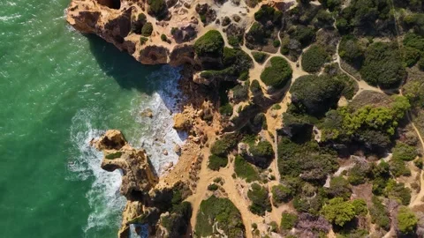
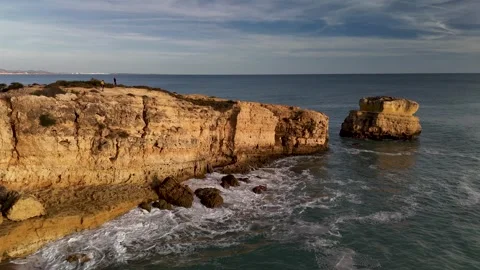
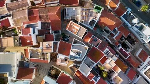
The coastline of southern Portugal isn’t just beaches; it is a structural wall of dissolving rock. I wanted to logically document this environment before further erosion alters it entirely. My aerial coverage focuses on the rugged intersection between the Atlantic and the mainland, capturing the aggressive limestone formations around Sesmarias and the isolated sea stacks near Evaristo. It is actually impressive how quickly the geography shifts from flat sand to vertical drops. I also ended up integrating a massive subset of 59 clips from Funchal. It might seem bizarre to group an isolated Atlantic island with the mainland southern coast, but from a practical filming perspective, they share the exact same maritime lighting conditions and architectural history built out of spite for the ocean. The layers of this collection allow an editor to seamlessly cut between a mainland sea cliff and a deep-water island harbor.
The logical reality of limestone erosion and sea caves
You cannot tell the authentic story of this region without addressing the massive erosion cavities, most notably the Benagil Sea Cave. Getting practical aerial coverage here requires precise timing to avoid the armada of tour boats. I shot extensive top-down drone work over the cave’s natural skylight, descending into the opening to capture the crashing waves inside. I mirrored this with gimbal work from the water level, looking up through the rock. The lighting inside these structures is unreal, functioning like a massive natural softbox during the mid-morning. Moving westward to Ponta da Piedade, I focused on high-altitude wide pans and tight circular orbits around the lighthouse and jagged offshore rocks. The sheer volume of aerials here gives you every possible angle of the headlands, providing logical establishing shots for any coastal sequence without relying on artificial lighting.
Coastal layers: isolated outposts and defensive architecture
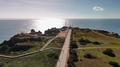
Structures built on the extreme edges of cliffs are inherently interesting. I spent a lot of battery life orbiting the Chapel Nossa Senhora da Rocha, a tiny white church stranded on a narrow limestone peninsula. I shot this from top-down, wide circles, and low fly-bys, treating it as an architectural anchor against the blue water. I applied the same exhaustive coverage to the Farol de Alfanzina lighthouse, rising up from the sea to reveal its precarious position on the cliff edge. Out in Funchal, the Forte de São Tiago serves a similar visual purpose. These isolated outposts are practical markers of human endurance. They provide a striking scale reference against the raw power of the ocean, grounding the aerial panoramas into something tangible and authentic.
Aerial dominance over the jagged beaches of Sesmarias
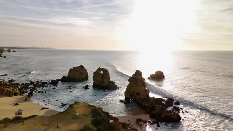
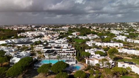
I wanted to break down the actual anatomy of the Algarve’s beaches rather than just pointing a camera at the sand. Along the Sesmarias coast, the geography is fractured and chaotic. I flew low, dynamic passes over Praia da Coelha and Praia do Castelo, mapping the limestone walls that isolate these coves. At Praia dos Arrifes and Praia dos Paradinha, I pushed the drone through narrow rock gaps and hovered top-down to show the water breaking over submerged shelves. At Praia da Nova and Praia da Corredoura, the focus was entirely on the stark contrast between the bright white rock and the deep blue water. These aren’t static landscapes; the aerial motion is designed to emphasize the rugged, three-dimensional complexity of a coastline that is constantly tearing itself apart.
Navigating the working rivers and inland estuaries
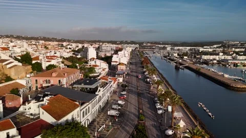
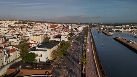
The Atlantic doesn’t just stop at the beaches; it bleeds inland through a series of tidal estuaries. I spent considerable time flying the Arade River, capturing the wide approaches to Portimão and the quieter fishing village of Ferragudo on the opposite bank. The visual contrast between the massive boats in the Portimão marina and the smaller vessels anchored at Ferragudo offers a highly practical storytelling transition. I duplicated this approach over the Bensafrim River in Lagos and the tidal boardwalks of Alvor. It is actually impressive to watch the water change texture as it moves from the open ocean into these sheltered river mouths. The drone work here is slow and deliberate, providing vast, sweeping pan-outs that establish the geographical context of the inland towns.
The practical light shifts across the Atlantic cycle
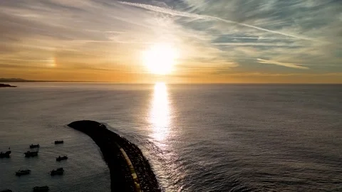
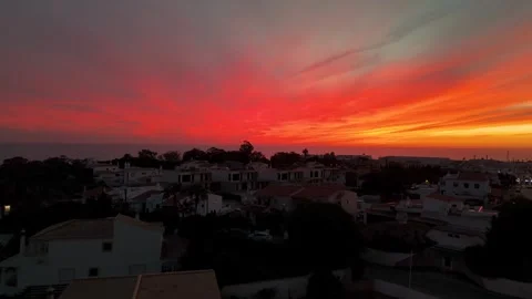
The light out here changes with brutal speed. I dedicated my early mornings to capturing the unreal sunrises over Funchal, taking the drone up to high altitudes to watch the island silhouette emerge from the dark Atlantic. The golden morning glow across the Funchal Marina and the Sé Cathedral provides rich, warm establishing shots. On the mainland, I pushed my flights into the dusk, circling the rugged coastline at Praia dos Paradinha and Albufeira as the sun dropped behind Ponta da Baleeira. The shadows inside the sea caves lengthen dramatically, and the limestone takes on a deep, saturated orange. I documented these shifts methodically. If you need a logical progression of time for a sequence, this collection covers the stark coastal mornings right through to the isolated, fading light of the Atlantic sunset.
Ground-level truths on the historic cobblestones
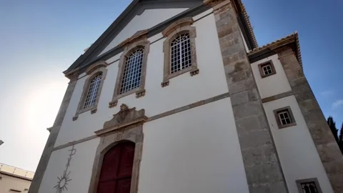
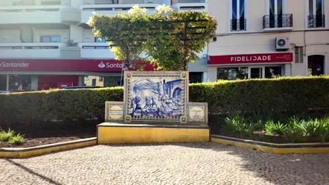
To anchor the massive scale of the drone work, I brought the camera down to the traditional Portuguese paving. The gimbal clips in this archive map the pedestrian experience through narrow, cobbled streets. I walked the uphill alleys of Lagos, passing modern street art that sits right next to centuries-old architecture like the Porta de São Gonçalo archway and the Church of Saint Anthony. I tracked through the Jardim Público de Albufeira and along the Avenida da Liberdade, finding the quiet corners away from the main commercial drag, ending up near the Igreja Matriz de Albufeira. In Portimão, I moved slowly past the Jardim 1 de Dezembro and looked up at the Igreja de Nossa Senhora da Conceição. Out on Madeira, I audited the Praça do Município, Paços do Concelho, and the Convent of Santa Clara. This ground-level coverage is vital. It proves the authentic layers of these cities, showing the tactile reality of the stone, the mosaic paving, and the peeling paint that survives in spite of the elements.