Does the standard visual narrative of Colombia actually survive a practical audit? I spent weeks filming the high-altitude sprawl of Bogota and the dense valleys of Antioquia to find out. Stripping away the tourist gloss, I found a landscape of stark extremes—from the isolated rock monoliths piercing the reservoirs to the brutalist brick logic of immense hillside neighborhoods.
Locations featured in Colombia
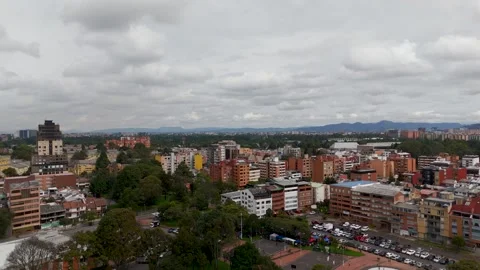
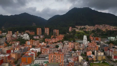
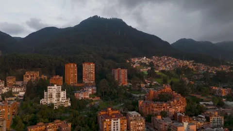
Chapinero
The dense eastern district where high-rise residential towers sit hard against the looming Andes mountains.
Ciudad Bolivar
The sprawling, brightly painted hillside communities connected by cable car infrastructure above the city.
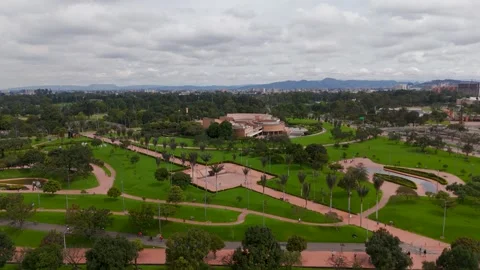
Simon Bolivar Park
The massive metropolitan green space providing a sharp geometric contrast to the surrounding urban density.
Public Library Virgilio Barco
Brutalist, circular concrete architecture sitting surrounded by water features within the city's largest park.
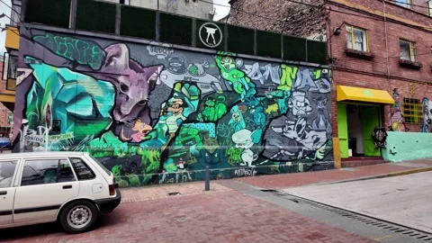
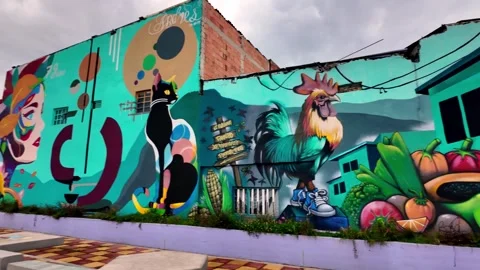
La Candelaria
The historic downtown grid covered in complex, massive street art murals and dense foot traffic.
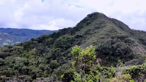
Monserrate
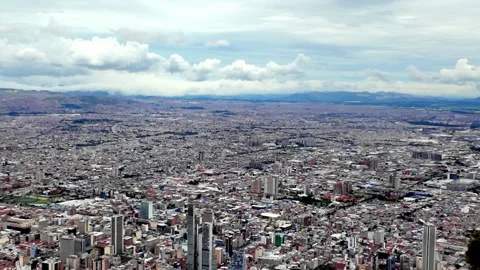
The towering mountain viewpoint accessed by funicular, offering expansive, weather-heavy panoramas of the valley.
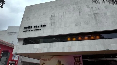
Museo del Oro
The imposing modern frontage of the gold museum positioned heavily against the street traffic.
Museo Botero
The colonial-style courtyard and fountain framed by heavy stonework and interior archways.
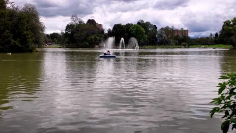
Parque de los Novios
A manicured urban oasis featuring tranquil lakes and dense tree canopies breaking up the concrete.
Barrio San Francisco
A steeply sloped neighborhood of tightly packed, brightly colored rooftops viewed from above.
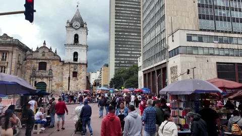
Iglesia de San Francisco
The historic stone church facade standing aggressively against the busy commercial street traffic.
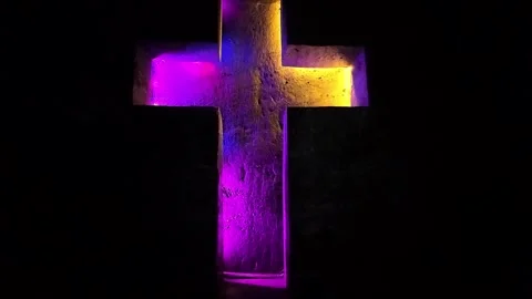
Zipaquira Salt Cathedral
The subterranean tunnels where massive illuminated crosses are carved directly into the rock walls.
Laguna de Guatavita
The sacred circular lake surrounded by lush, crater-like green hills constantly wrapped in cloud.
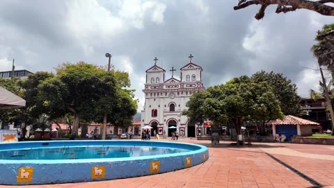
Sesquile
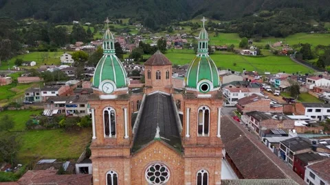
An isolated rural town defined by its prominent central church tower and surrounding mountain landscape.
El Penon de Guatape
The massive, bizarre inselberg rock monolith jutting hundreds of feet out of the Andean landscape.
Penol Guatape Reservoir
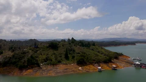
A vast flooded landscape where scattered islands and modern villas intermix with historic ruins.
Plazoleta de Los Zócalos
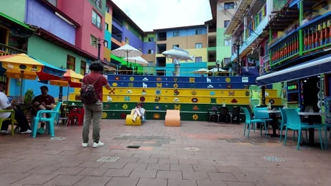
The terraced town square covered entirely in vibrantly painted bas-relief murals and colorful steps.
Nuestra Señora Del Carmen Church
The historic white and red church anchoring the main cobblestone square of Guatape.
Casa Cural
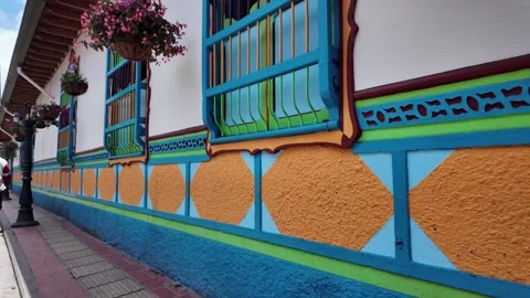
The highly detailed colonial facade known for its elaborate and colorful zócalo murals.
El Poblado
The bustling commercial district where bright yellow city buses navigate deep, green-lined streets.
Parque de La Presidenta
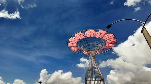
A deeply shaded, linear urban park offering a quiet green artery through Medellin's core.
La Catedral
The crumbling mountain ruins of Pablo Escobar's former prison overlooking the vast Medellin valley.
Inflexión Memorial Park
The somber, modern memorial sculpture built over the former site of the Monaco building.
Comuna 13
The incredibly steep, mural-heavy hillside barrio famous for its integrated outdoor escalator network.
Plaza Botero
The wide, exposed city square filled with massive bronze sculptures and heavy pedestrian flow.
Museum of Antioquia
The grand architectural facade looking out over the crowded central plazas of Medellin.
Palace of Culture Rafael Uribe Uribe
A striking, highly detailed Gothic Revival building with a complex internal courtyard.
Parroquia de la Veracruz
The historic church facade set against the chaotic, modern downtown commercial backdrop.
Laureles
The leafy, residential neighborhoods defined by wide circular streets and thick tree canopies.
Primer Parque de Laureles
The central, shaded circular park serving as a quiet focal point in the neighborhood.
Segundo Parque de Laureles
The secondary urban park featuring a central sculpture and surrounded by heavily greened architecture.
The sheer scale of the high-altitude sprawl
The reality of filming Colombia’s capital is wrestling with its immense, relentless geography. I put the drone up over the Chapinero district, where modern residential towers stack aggressively against the sheer face of the Andes mountains. There is no neat grid here; the city bleeds up into the hills out of practical necessity. Flying over the vast brick expanse of Ciudad Bolivar, the density is staggering. The TransMicable cable car system isn’t a leisure ride; it’s a necessary artery connecting isolated hilltop communities, like Barrio San Francisco, to the basin below. My aerials track these cables cutting over the roofs, offering a completely unfiltered look at the urban scale.
Ground-level architectural realities over tourist gloss
I avoided the sanitized framing to shoot the actual streets. In La Candelaria, the street art isn’t just decorative; it covers massive building facades with complex, layered murals that define the district. I walked the busy commercial intersections, filming the heavy foot traffic, the bright yellow buses, and the spite of greenery fighting through the concrete in El Poblado. The historical architecture is equally imposing. Panning up the Gothic Revival facade of the Palace of Culture Rafael Uribe Uribe or framing the courtyard of the Museo Botero requires acknowledging the heavy, unyielding stonework. Even in Guatape, where the Casa Cural and the Plazoleta de Los Zócalos are covered in brightly painted murals, the visual impact comes from the sheer density of the color against the rugged Andean backdrop.
Engineering and infrastructure as visual anchors
To understand these cities, I focused on how people are forced to move through them. The topography demands bizarre engineering solutions. I spent time riding the outdoor escalators built directly into the steep slopes of Comuna 13, framing the dense architecture alongside the people using the infrastructure. In Bogota, the brutalist geometry of the Public Library Virgilio Barco sitting inside Simon Bolivar Park provides incredible, sharp lines against the sprawling metropolitan green space. Even out in the rural areas, infrastructure tells the story. I tracked boats navigating the flooded Penol Guatape Reservoir, catching the bizarre sight of the old Peñol town cross marker rising out of the water, right alongside Pablo Escobar’s decaying luxury villa.
The monolithic geology of Antioquia and Cundinamarca
You cannot shoot this country without acknowledging the terrifyingly large rock formations and valleys that interrupt the landscape. El Penon de Guatape is a massive inselberg rock that completely dominates the skyline. My drone orbits capture this bizarre geological anomaly jutting out of the lakes, dwarfing the modern villas along the shore. Further south, the geology goes underground. I took the camera down into the Zipaquira Salt Cathedral to capture the illuminated crosses carved directly into the subterranean salt tunnels. Above ground, the green, crater-like hills surrounding the Laguna de Guatavita provide an isolating landscape that feels entirely disconnected from the sprawling cities just a few dozen miles away.
Navigating light and weather at elevation
The atmospheric conditions here are completely unpredictable, and that plays heavily into the footage. At 2,600 metres, Bogota’s weather shifts in minutes. I captured wide timelapses from the top of Monserrate as rainclouds swallowed the skyline, only for the sun to punch through and light up the Parque de los Novios below. Golden hour over Chapinero turns the brickwork into a rich, glowing red, but you have to work fast before the shadows from the Andes plunge the city into dusk. Whether I was catching the early morning mist over the Primer Parque de Laureles in Medellin or framing the cloudy skies above the historic church tower in Sesquile, I learned quickly that the volatile weather dictates the shoot.