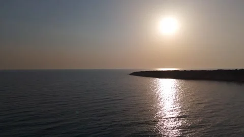
Let’s logically audit Cyprus. Its reputation rests heavily on crowded summer beaches, but I shot this island in winter when the haze lifts and the underlying architecture actually reveals itself. This isn’t a sunny holiday reel; it’s a 454-clip drone study of bizarre geological divides, isolated mountain monasteries, and the stark contrast of a walled capital city.
Locations featured in Cyprus
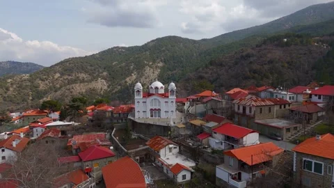
Kato Drys
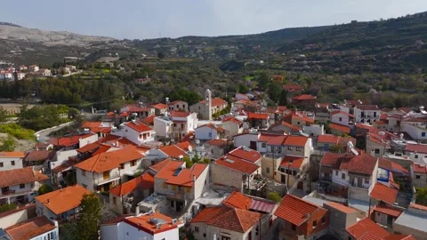
A traditional mountain village characterized by narrow, maze-like streets, colorful houses, and the prominent Saint Charalambos Church.
Oroklini
A hillside area featuring terraced slopes, modern housing developments, and the Holy Church of Archangel Michael.
Pano Lefkara
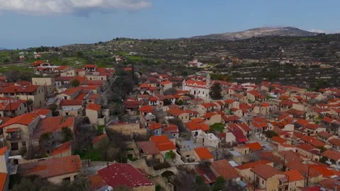
Historic mountain village built into the steep slopes, known for its dense traditional stone rooftops and central main church.
Kato Lefkara
The lower companion village to Pano Lefkara, situated deep in a rural valley surrounded by reservoirs and hills.
Lemesos Castle
A historic stone fortress situated in the dense urban core of Limassol near the old port.
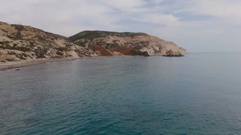
Cape Aspro
A dramatic stretch of sheer white chalk cliffs dropping vertically into the bright turquoise Mediterranean Sea.
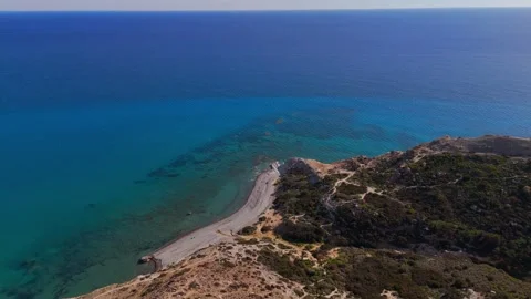
Skiplili Beach
An isolated, narrow strip of coastline shadowed by the massive white cliffs of the Pissouri region.
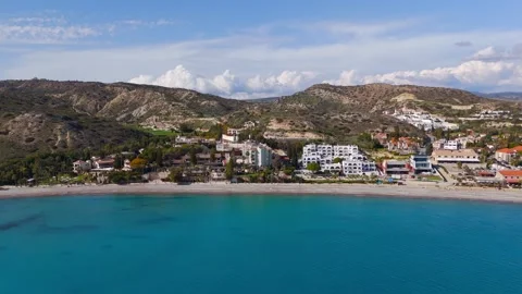
Pissouri Beach
A sweeping coastal bay backed by rugged hills and scattered luxury villas, leading directly into the white cliff faces.
Avdimou Bay
A wide coastal expanse featuring green cliff plateaus, golden sands, and ancient coastal stone circles.
Melanda Beach
A flat, sandy stretch within Avdimou Bay backed by lush green winter fields and frequented by kitesurfers.
Kouris Dam
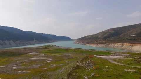
The island's largest reservoir, featuring steep earthen banks and a haunting submerged ruined church in its waters.
Alassa
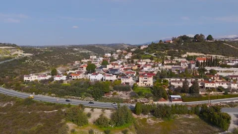
A quiet residential village situated on the highway overlooking the vast expanse of the Kouris reservoir.
Laneia
A heavily historic village in the Limassol winter valley with winding streets and a central Orthodox church.
Lofou
An exceptionally well-preserved stone village in the Troodos mountains, centered around the large Church of Annunciation.
Koilani
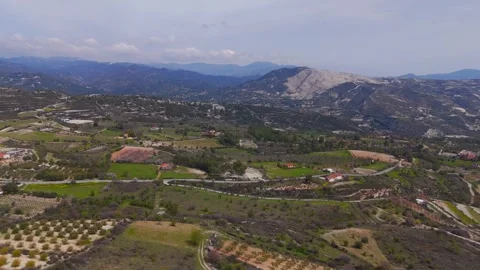
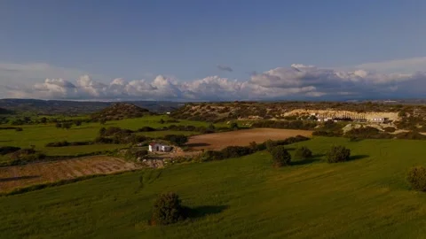
A traditional mountain settlement surrounded by winter fields, terraced farms, and deep valleys in the Troodos range.
Pera Pedi
A small mountain village nestled deep in the heavily forested hills of the Troodos region.
Omodos
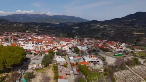
A prominent historic village known for the Holy Cross Monastery and surrounding rugged, fire-prone hills.
Pedoulas
High-altitude mountain village featuring the Church of Holy Cross, filmed distinctly under heavy winter snow.
Moutoullas
A steep valley village featuring traditional stone houses and the historic Agia Paraskeui Church built into the slope.
Kalopanayiotis
A deep-valley settlement in the Troodos Mountains, surrounded by dense winter forest and steep drops.
Mavralis Beach
A quiet, undeveloped stretch of shingle beach near Limni featuring a distinct, isolated wooden pier.
Latsi
A coastal town in the Paphos district defined by its busy marina, harbor breakwaters, and lush inland fields.
Akamas Peninsula
A massive, rugged national park region of highland forests, deep gorges, and unspoiled rocky coastline.
Neo Chorio
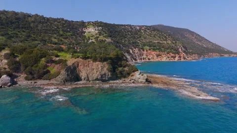
A coastal area featuring highly rugged rock promontories extending into the clear Mediterranean water.
Aphrodite's Beach
A wild, rocky stretch of coastline near the Akamas Peninsula, dotted with offshore rock formations.
Gabor Volcanic Rock
A bizarre, dark volcanic rock formation protruding from the coast, crowned with a stark white cross.
Green Lagoon
An isolated cove in the Akamas Peninsula known for its vivid, intense water coloration and steep enclosing hills.
Avakas Gorge
A deeply cut, twisting limestone canyon carving aggressively through the green Paphos landscape toward the sea.
Geronisos Island
A small, sheer-sided uninhabited island sitting isolated off the rugged Pegeia coastline.
Pegeia
A coastal municipality characterized by luxury villas backing onto a coastline of natural sea arches and white cliffs.
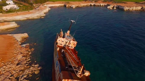
Edro III Shipwreck
A massive, rusting cargo ship wedged permanently onto the rocks near the sea caves of the Paphos coast.
Coral Bay
A sweeping, golden sand bay featuring gentle waves and low coastal promontories.
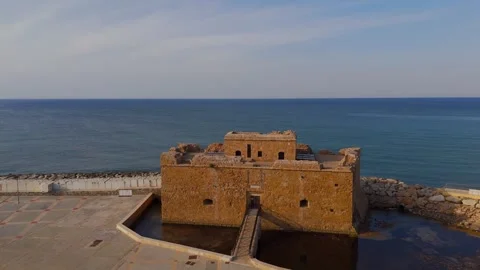
Paphos Castle
A squat, historic stone fort guarding the entrance to the busy Paphos harbour and boardwalk.
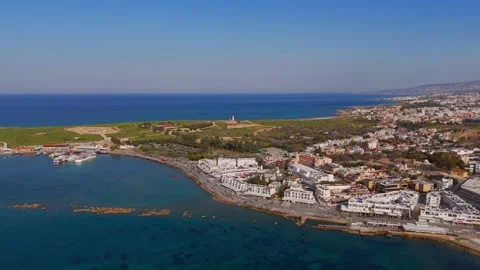
Paphos Lighthouse
An iconic white coastal lighthouse situated heavily within the expansive Paphos archaeological site.
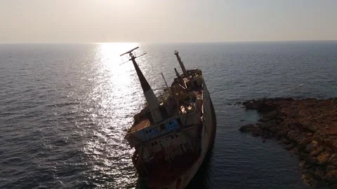
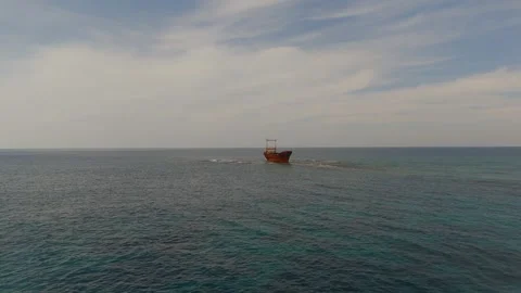
MV Dimitrios II Shipwreck
A stranded cargo ship sitting upright on a rocky offshore reef, battered by the Mediterranean winter sea.
Petra tou Romiou
Also known as Aphrodite's Rock, a cluster of massive geological formations sitting off a rugged, pebbled beach.
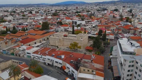
Nicosia Walled City
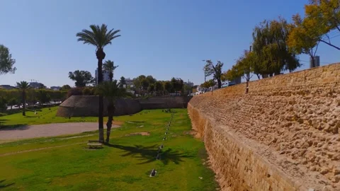
The densely packed, historic core of the capital, bound entirely by star-shaped defensive walls and moats.
Podocatoro Bastion
One of the distinct, arrow-shaped defensive points on the Venetian Walls surrounding the old city of Nicosia.
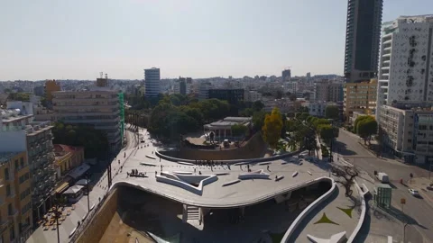
Eleftheria Square
A starkly modern, geometric plaza cutting through the historic fabric of Nicosia's center.
Why a winter audit actually makes practical sense
To logically evaluate a Mediterranean island, you have to strip away the summer crowds and look at the bare geology. I spent my time in Cyprus documenting the landscape during the winter months, when the harsh summer light softens and the air clarity allows for massive visibility across the valleys. My coverage proves that the island is far more impressive when it isn’t catering to mass tourism. I found snow covering the red tiles of the Church of Holy Cross Pedoulas, while down on the coast at Coral Bay and Kerynias Beach, the Mediterranean Sea was completely empty and striking. The empty golden sands at Mavralis Beach and the quiet, overcast skies rolling over Petra tou Romiou gave me the atmospheric conditions necessary to shoot highly cinematic, contrast-heavy establishing shots. This is the authentic island, functioning on its own terms.
The sheer verticality of the southern coastline
The chalk cliffs running along the southern edge provide some of the most rugged and dramatic aerial drops in the region. I tracked my drone extensively around Cape Aspro, capturing the sheer white rock dropping vertically into the azure water. The top-down aerials over Skiplili Beach and Pissouri Beach highlight a harsh, eroding environment that feels completely isolated. Moving further east, I flew sweeping passes over Avdimou Bay and Melanda Beach, documenting the green coastal plateaus and the ancient stone circles that sit inexplicably near the cliff edges. The drone work here is highly practical—I relied on slow, calculating push-ins and vertical top-down shots to emphasize the bizarre contrast between the bright white chalk, the turquoise water, and the lush winter greenery of the cliff tops.
Tracking the architectural layers of a divided capital
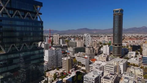
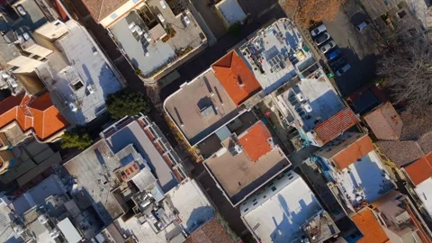
Nicosia is a bizarre, deeply layered urban environment that demands a highly structured flight plan to capture its contrasting halves. From the air, the Venetian Walls and the Podocatoro Bastion form a physical, undeniable boundary around the Old Walled City. I flew multiple orbits over the dense historic core, contrasting the ancient architecture of the Selimiye Camii and the Omeriye Mosque against the rapidly encroaching modern skyline. The airspace here is a study in contrasts; my footage tracks from the historic Faneromeni Church and St. John’s Cathedral straight into the sleek, modern glass facades of Tower 25 and the Shacolas Tower. Sweeping over Eleftheria Square, you can see exactly how the city attempts to stitch its fragmented history together. It’s a surreal landscape, and documenting these layers from a bird’s-eye view was the only logical way to map the divide.
Isolation and the Troodos mountain circuits
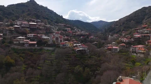
Pushing inland into the Troodos mountains reveals an entirely different side of the island built on steep, terraced valleys. I spent days navigating the winding roads to document the labyrinthine stone rooftops of Kato Drys, Pano Lefkara, and Kato Lefkara. The villages here cling to the hillsides out of sheer necessity. I flew low-altitude passes over the Holy Cross Monastery in Omodos, even navigating through actual wild bush fire smoke that had flared up in the surrounding hills. The isolation of these communities is unreal. My aerials push deep into the valleys toward Lofou, Koilani, and Pera Pedi, revealing narrow cobbled streets and historic churches built into the rock. Pushing further up, I captured the stark, remote beauty of Moutoullas and Kalopanayiotis, proving that the island’s interior holds a massive geographic footprint completely removed from the coastal developments.
Shipwrecks, spite, and offshore anomalies
The western seaboard is littered with navigational mistakes and bizarre geological formations that make for unreal aerial tracking. I spent a significant amount of time circling the Edro III Shipwreck off Pegeia; at golden hour, this massive, rusting hulk pinned against the sea caves looks like a monument to maritime spite. Further down the coast, I pushed the drone out over the reef to map the MV Dimitrios II shipwreck, isolated and battered by the winter waves. The natural formations are equally strange. I flew tight maneuvers around the natural sea arches near Ektoras Beach and pushed out to the completely barren Geronisos Island. Up near Neo Chorio, the volcanic anomaly of Gabor Rock—topped with a stark white cross—sits off Aphrodite’s Beach like a warning marker. It’s a harsh, unforgiving stretch of coastline.
The massive footprint of the inland reservoir systems
The geography of the interior is heavily dictated by massive water management projects that have physically drowned older settlements. Surveying the Kouris Dam was a priority. I flew low over the massive body of winter water to document the eerie, submerged ruined church that still breaches the surface, contrasting it directly with the modern Agia Paraskevi Church built safely on the shore. The drone descents into Alassa and the valley approaches toward Laneia show how the modern infrastructure has reshaped the environment. The topography here is highly impressive; the terraced farming landscapes near Oroklini Park and the Prophet Illias Church highlight the relentless human effort to cultivate an otherwise arid, rocky terrain.
Coastal urban density and historic harbors
Surveying the major port cities from the air reveals a chaotic blend of ancient fortifications and rapidly expanding modern infrastructure. In Paphos, I tracked from the historic Paphos Castle and the coastal boardwalk directly up to the Paphos Lighthouse and the sprawling archaeological sites. The low-altitude flights over Kennedy Square, Platia Eptoras, and the Holy Bishopric of Pafos required careful timing with the morning light. Over in Limassol, my coverage maps the dense urban sprawl, flying past Lemesos Castle and the Holy Cathedral of Virgin Mary Pantanassis before sweeping out over the modern marina and luxury towers. On the northwest edge, the marina at Latsi transitions abruptly into the wild, rugged terrain of the Akamas Peninsula. Here, I documented the deep cuts of the Avakas Gorge and the remote, intensely colored waters of the Green Lagoon, proving that even at its edges, Cyprus remains a deeply fractured, visually arresting environment.