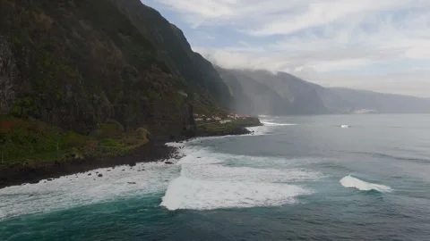
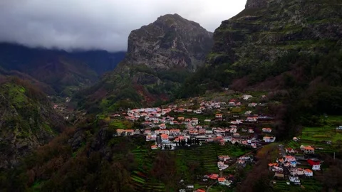
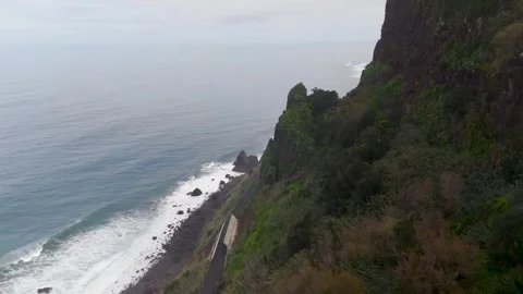
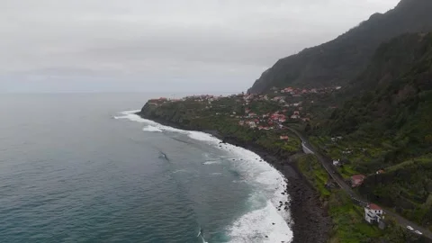
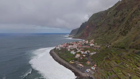
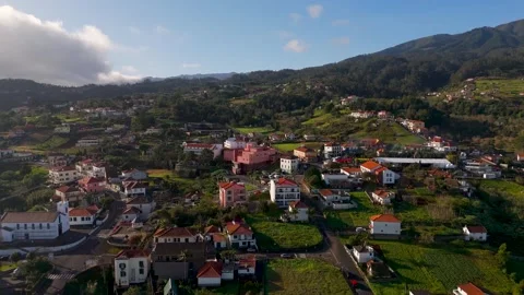
Madeira is routinely sold as a European Hawaii, which is a reductive way to explain a piece of rock this aggressively vertical. I spent my time here entirely in the air, auditing the sheer drops, volcanic coastlines, and rapid micro-climates that define the island. This coverage strips away the tourist board gloss to show what the terrain actually demands from a camera.
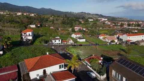
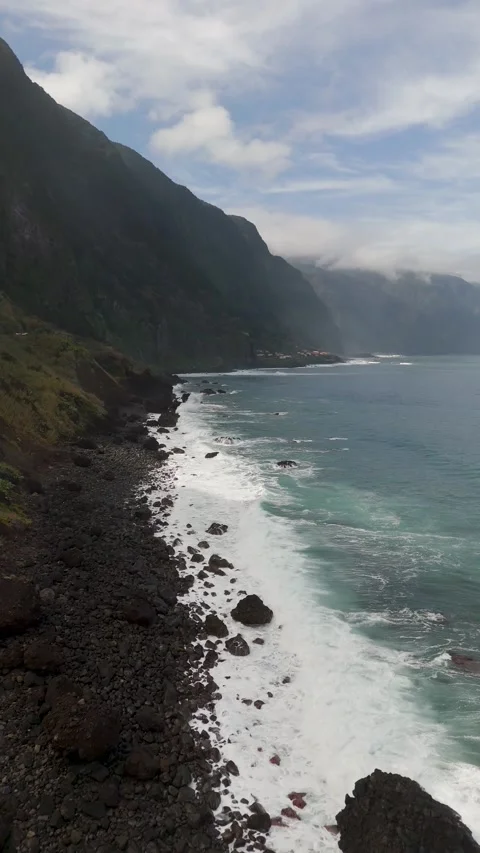
Locations featured in Madeira
Câmara de Lobos
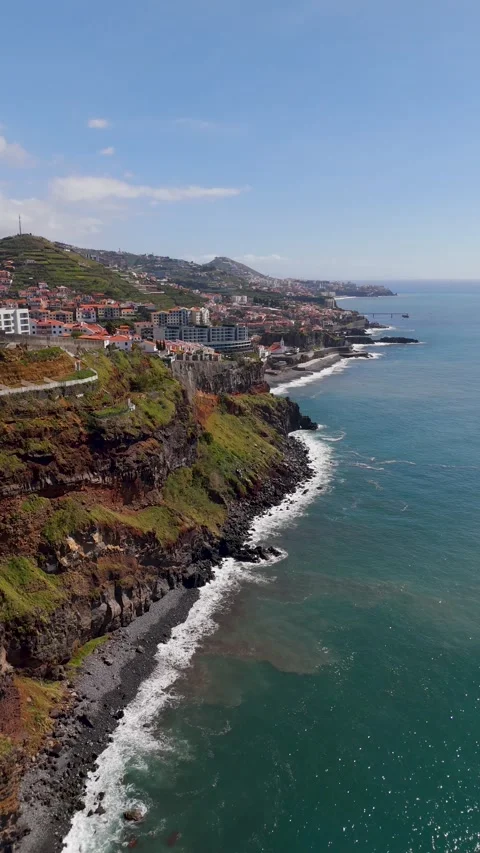
Dense coastal town built directly onto steep terrain and black volcanic rock piers.
Jardim do Mar
Isolated coastal village in Calheta featuring tight rooftops and cliff-hugging roads.
Curral das Freiras
Also known as the Valley of the Nuns, an isolated settlement trapped deep within a massive crater-like valley.
Fajã da Ovelha
High-altitude coastal parish where the Igreja Matriz church sits near severe, cloud-topped drops to the ocean.
Paul do Mar
Narrow fishing village squeezed between towering rock walls and the Atlantic surf, featuring a prominent waterfall.
Miradouro das Quebradas
Steep northern viewpoint overlooking aggressive coastal drops, crashing waves, and cliffside houses.
Arco de São Jorge
Coastal town perched on a lush plateau before a sudden, sheer drop to the Atlantic.
Ponta Delgada
Atmospheric northern valley and coastal settlement often caught in low clouds and heavy surf.
Guindaste
Dramatic headland in Faial featuring high glass observation decks over the ocean.
Praia do Faial
Coastal bathing complex nestled into the cove near Guindaste, surrounded by steep topography.
Cascata Paul do Mar
Prominent waterfall carving its way down the sheer rock face behind the town of Paul do Mar.
Ponta do Sol
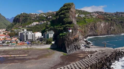
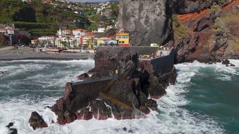
Southern coastal town known for its colourful buildings, pebble beach, and the iconic Rocha Kamasora.
Cascata da Praia
Coastal waterfall dropping heavily near the beach and infrastructure of Ponta do Sol.
Rocha do Navio
Coastal nature reserve in Santana featuring sheer cliffs, waterfalls, and offshore islets.
Ribeira Brava
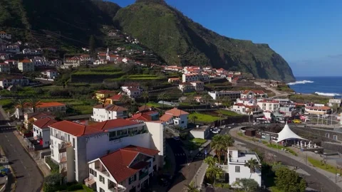
Town tightly packed into a steep river valley that opens directly onto the southern coastline.
Ribeira da Janela
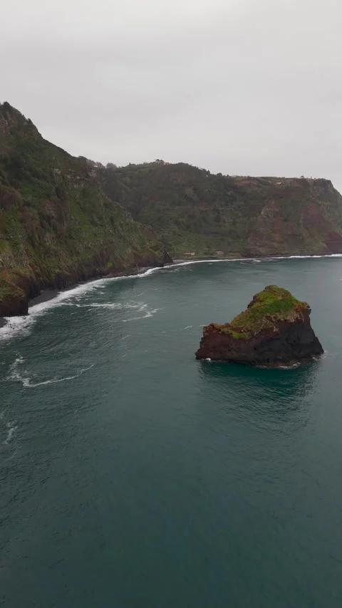
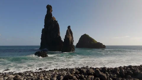
Jagged, massive volcanic sea stacks rising aggressively out of the Atlantic surf.
Porto Moniz
North-western town famous for its natural lava rock sea pools and white coastal architecture.
Ilhéu Mole
Distinctive domed islet sitting just off the coast of the Porto Moniz pools.
Porto da Cruz
Coastal settlement featuring the Alagoa beach, a prominent Catholic church, and sheer drops.
Ilhéu de Porto da Cruz
Rocky island formation sitting offshore from the main Porto da Cruz waterfront.
Penha d'Águia
The massive, imposing rock formation that dominates the skyline above Porto da Cruz.
Ponta do Tristão
The extreme northern tip of the island where lush farmland simply ends in vertical cliffs.
São Vicente
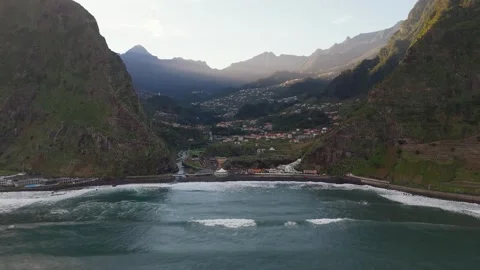
Deep, lush northern valley where a river cuts through the mountains to meet the Atlantic.
Capela de Nossa Senhora de Fátima
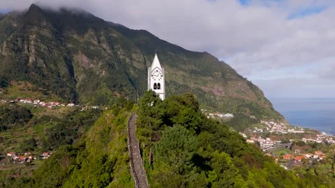
Isolated white Catholic chapel sitting prominently on a central hill within the São Vicente valley.
Santana
Rural northern town known for its traditional A-frame, thatched-roof Casas Típicas.
São Jorge
Rugged coastal area featuring a river mouth, ruins, and aggressive ocean surf.
Ilhéu da Rocha das Vinhas
Small, battered island rock formation situated just off the coast of São Jorge.
Seixal
Dramatic northern coastline defined by natural volcanic rock pools and dense green mountain backdrops.
Achadas da Cruz
Towering western cliffs featuring a steep cable car and agricultural fajã at the ocean's edge.
Cascata Ribeira de Santo António
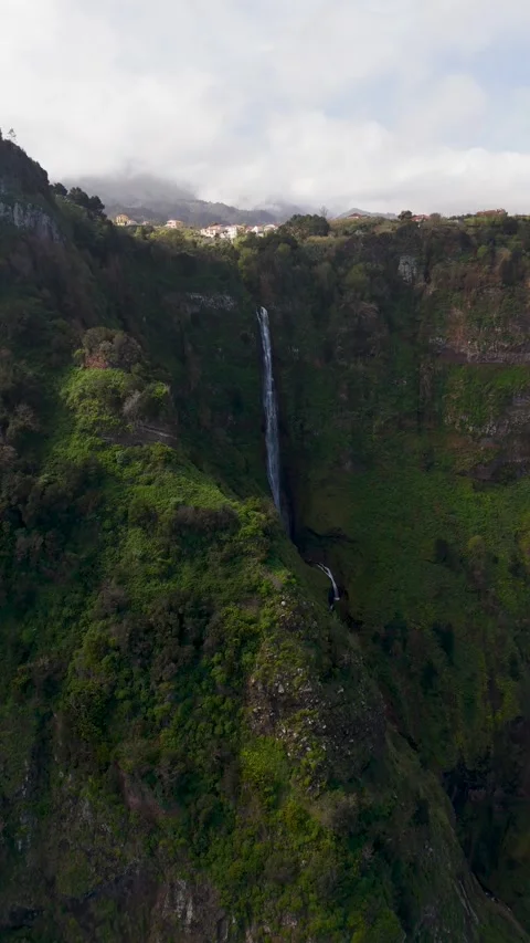
Inland waterfall surrounded by dense, vertical vegetation.
Why the altitude dictates the narrative
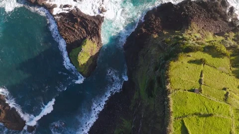
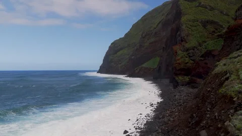
The island’s topography dictates every shot, forcing the camera to confront vertical drops rather than rolling horizons. When you put a drone up at Achadas da Cruz or the cloud-topped drops of Fajã da Ovelha, you quickly realise this isn’t a place of gentle slopes. The cliffs here feel built out of spite. My aerial coverage focuses heavily on this verticality, tracking the sheer rock faces that plunge directly into the Atlantic Ocean. Flying near Ponta do Tristão reveals a coastline that simply gives up and falls away, offering zero transition between the lush farmland on top and the violent water below. Capturing this requires positioning the camera to look straight down or framing the ascent to emphasise the bizarre scale of the terrain. There is no flat ground to rely on; every establishing shot is fundamentally a demonstration of height.
The northern coastline’s aggressive geology
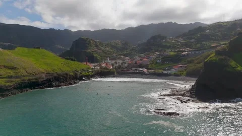
The northern coast presents an onslaught of crashing waves against black volcanic rock, offering the most brutal and cinematically useful contrast on the island. I spent a significant amount of battery life tracking the wave impacts along Miradouro das Quebradas and the dark, jagged edges of Seixal. The natural volcanic rock pools here are impressive, not because they are pristine, but because they look like they were violently carved out of the mainland. Further along, the massive jagged sea stacks rising out of the surf at Ribeira da Janela provide immense foreground anchor points for wide ocean sweeps. The footage from Porto Moniz contrasts the raw power of the Atlantic with the stark white coastal houses that have logically, if precariously, clustered around the natural lava rock sea pools.
Auditing the isolated valley settlements
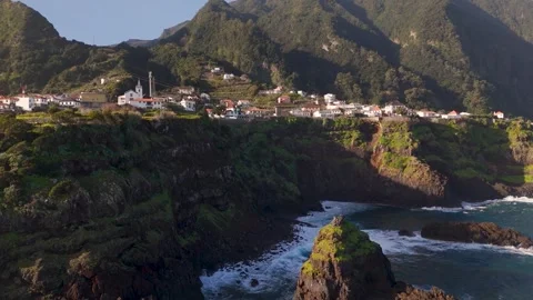
Human settlements here exist strictly where the mountains allow them, resulting in dense architectural clusters hemmed in by sheer rock. You see this most clearly circling the Valley of the Nuns, or Curral das Freiras. I flew multiple passes over this isolated town, which sits in a massive geological depression, entirely dwarfed by the surrounding peaks. It’s an incredibly practical demonstration of humans making do with the only flat space available. I documented similar geographical traps at São Vicente, where the deep valley channels a river straight out to the ocean. Capturing the isolated Capela de Nossa Senhora de Fátima, a stark white chapel sitting alone on a hill overlooking the São Vicente valley, provides a perfect focal point against the chaotic green slopes. Down at Ribeira Brava, the town centre and its church are similarly squeezed into a valley floor, forcing the drone to either shoot top-down or pull back to reveal the imposing ridges boxing the settlement in.
Weather systems and the coastal micro-climates
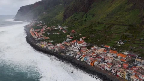
The coastal micro-climates mean you are constantly chasing or escaping weather fronts that roll in off the Atlantic, completely altering the lighting conditions from one bay to the next. Atmospheric moisture frequently gets trapped in the valleys of Ponta Delgada on the north coast, resulting in moody, misty flyovers where the church and cliffside houses drift in and out of the cloud cover. I found the southern coast, by contrast, offered much harsher, direct light. At Ponta do Sol, I tracked the colourful buildings and the pebble beach under totally different conditions, capturing the light hitting the Rocha Kamasora pier and the Cascata da Praia waterfall. Further along at Paul do Mar, the combination of towering cliffs, a tight harbour wall, and rolling Atlantic storms provided a highly volatile environment to document. The camera captures how quickly a bright coastal scene can be consumed by ocean spray and low clouds.
Volcanic rock features and offshore islets
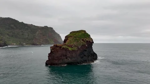
Offshore rock formations provide vital foreground elements that give the endless Atlantic Ocean a much-needed sense of scale. Without them, drone footage over water becomes completely abstract. I spent hours circling Ilhéu Mole off the coast of Porto Moniz, using the domed islet to ground the panning shots of the wider bay. At São Jorge, the isolated rock of Ilhéu da Rocha das Vinhas sits just offshore, constantly hammered by the surf. Flying low over these formations highlights the erosive reality of the environment. In Porto da Cruz, the towering mass of Penha d’Águia dominates the entire bay, making the Catholic church and Alagoa Beach look temporary by comparison. In the Rocha do Navio nature reserve near Santana, the offshore islets are backed by sheer cliffs and cascading waterfalls, creating a layered, hostile landscape that is incredibly rewarding to audit from the air.
Structural anomalies clinging to the edge
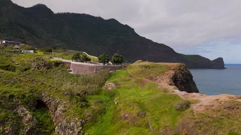
The infrastructure required to navigate this island is as visually impressive as the raw nature it cuts through. There is a bizarre stubbornness to the architecture here. I documented the cliffside houses of Câmara de Lobos, tracing the black volcanic rock pier and the densely packed rooftops that seem one minor landslide away from the ocean. At the Guindaste Viewpoint in Faial, the newly built glass observation decks jut out over the void in a way that feels utterly illogical but makes for brilliant top-down tracking shots. Inland, I flew low circles around the traditional thatched Casas Típicas in Santana, contrasting the rural, practical farmland with the sheer drops just a few hundred metres away. Even the approach to Jardim do Mar in Calheta reveals coastal roads hugging the cliff edge in a feat of engineering that defies basic common sense.
Practical realities of flying the Atlantic wind shear
The physical reality of piloting a drone here involves negotiating severe updrafts, narrow flight windows, and the constant threat of losing the craft to the ocean. I pushed the drone vertically past the towering cliffs of Arco de São Jorge, where the wind funnels violently off the water. The vertical descents near the Cascata Ribeira de Santo António waterfall require precise, close-proximity flying against wet, unpredictable rock faces. Every coastal approach—whether pulling back from the Faial Bathing Complex or rising up over the cliff-edge drop at Achadas da Cruz—is a calculated risk. The resulting footage doesn’t just show a pretty landscape; it documents the kinetic energy and hostility of an island sitting exposed in the middle of the Atlantic. It’s an incredible place to point a camera, provided you accept the logistical nightmare of actually doing so.